Multi Function Displays
 Radars
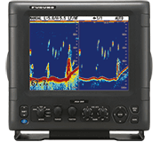 Fish Finders & Transducers
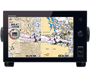 GPS & Chart Plotters
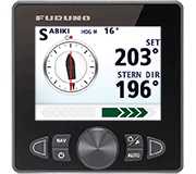 Autopilots
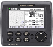 Navigation
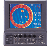 Sonars
 Commercial
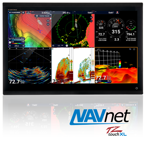
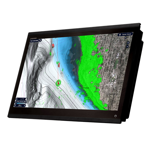
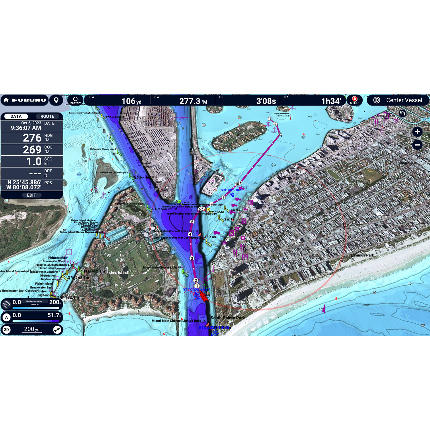
TZT24X
MSRP: $11,995.00
NavNet TZtouchXL Chart Plotter, 24" All-Glass IPS Display FULL HD (1920x1080)
Chart Type3D Data or C-Map or CMOR or Raster or Vector or Satellite Photo or TZ MAPS
Display Size24 inches
Display TypeColor Multi Touch LCD
Power Usage12-24 VDC
Prices and Specifications Subject to Change Without Notice.
All prices shown are in USD. Prices are valid in US and Canada only.
Powerful Technology
Explore the future of navigation with NavNet TZtouchXL - extra-large, wide 16", 22", and 24" all-glass Multi Function Displays with exceptional clarity from all angles that enhance the functionality and style of your helm. Or go with the hybrid controls of the 10" & 13" options that make navigating intuitive and easy under any sea conditions, no matter the size of your vessel. NavNet TZtouchXL delivers the ability to tailor the helm to meet the captain's exact needs, with magnetron or Solid-State Doppler Radars, high-powered Fish Finders, AIS, Autopilot, and Deep Water Multibeam Sonar options, and more!
NavNet TZtouchXL delivers new features like TZ MAPS with BathyVision, the most advanced and capable electronic charts in the world. The TZ Maps engine draws upon a worldwide database of high-resolution information to create crisp, clear navigation with a variety of color themes and fishing charts with fully editable color palettes. TZ Maps deliver a timeless navigation experience at any magnification. It sounds incredible, and it is - you have to see it to believe it!
A Dream Machine for Fishing Fanatics
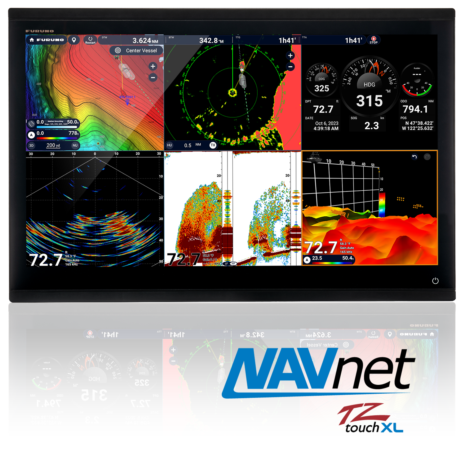
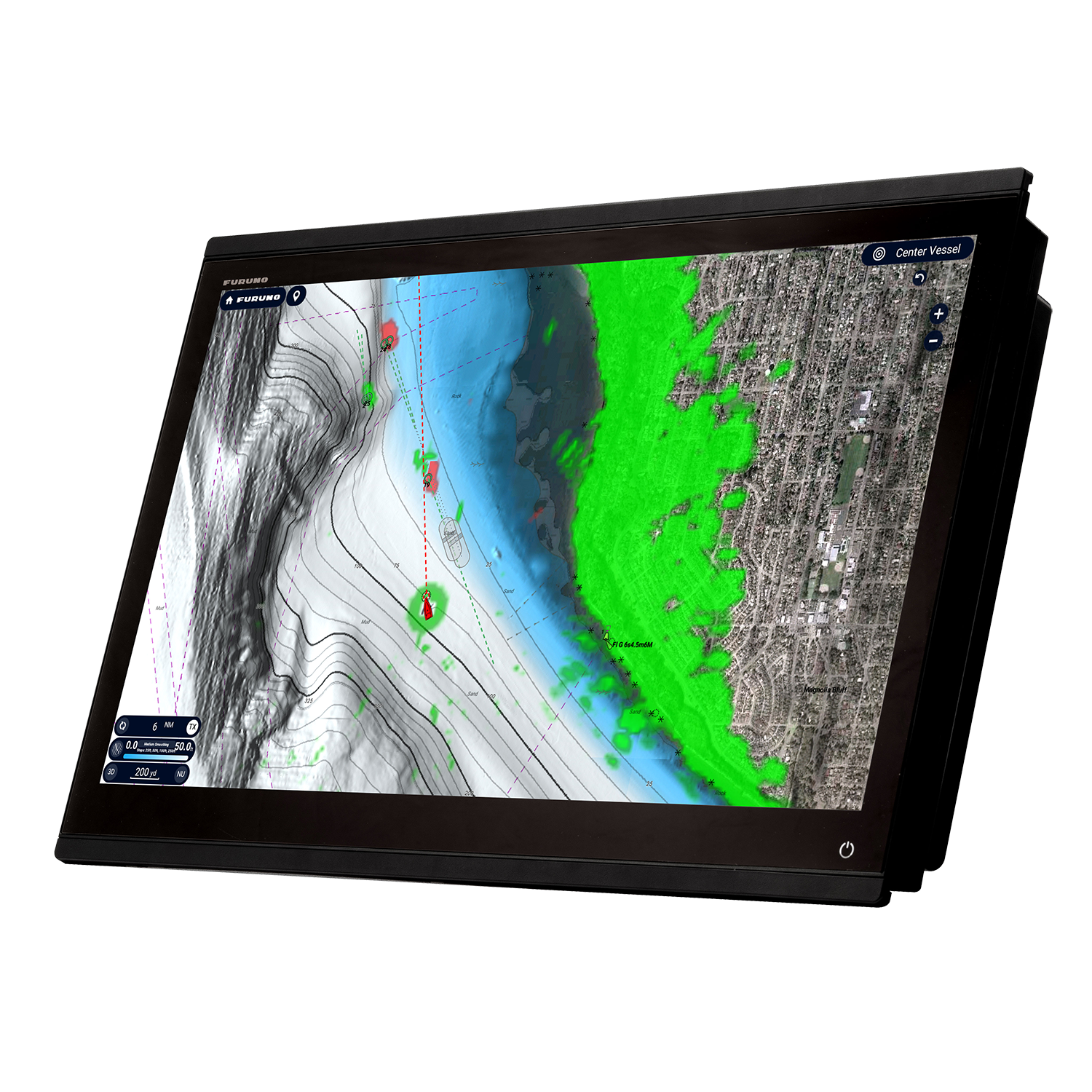
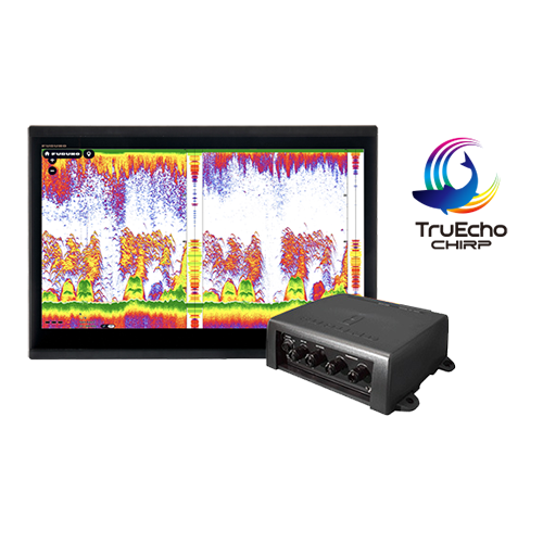
We've raised the bar for sportfishing enthusiasts once again with an MFD series designed to cater to the needs of avid anglers. The NavNet TZtouchXL series includes all the features fishermen desire, including exclusive, never-before-seen features in recreational navigation devices. The TZT10X, TZT13X, and TZT16X feature a built-in 1kW TruEcho™ CHIRP or CW Fish Finder as well as built-in 230kHz or 455kHz CHIRP Side-Scan to show fish and fish-hoarding structure in great detail port to starboard, providing crucial insights for successful fishing trips. The TZT22X and TZT24X have full control across the NavNet network, and you can tailor the system with a wide array of high-powered Fish Finders for deep dropping.
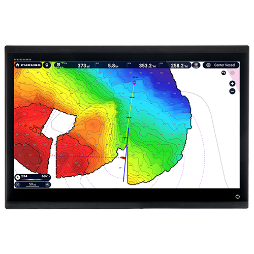
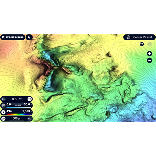
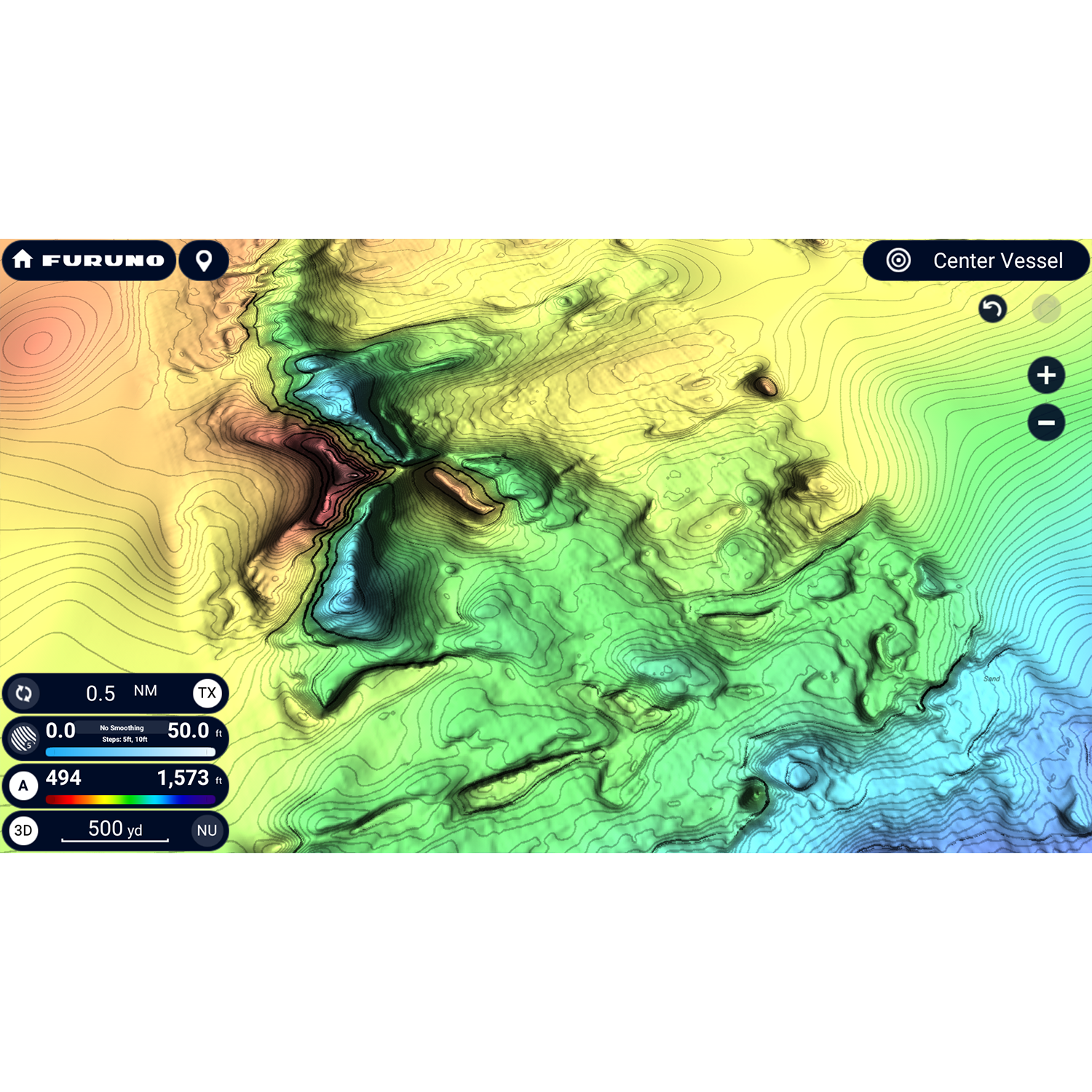
Deep Water Multibeam Sonar
Normal down-sounding Fish Finders have a beam angle of 40˚ or less. But with the DFF3D Multibeam Sonar, you'll see a 120-degree swath, offering seafloor coverage up to 3X water depth. Plus, with the power of the DFF3D, you can see fish directly below the boat 300m (nearly 1,000ft). The DFF3D's versatile operating modes give you a better understanding of fish targets than any normal Fish Finder can deliver. The 3D sounder history provides an intuitive and easy-to-understand 3D image of the seafloor, along with fish school icons - useful when selecting a fishing hot spot or assessing the seabed condition. Triple-Beam mode tells you not only the depth but also the direction (port/down/starboard) of fish targets. Cross Section display the real-time sea column echo in a 120˚ swath, and Side-Scan displays the shape and structure of targets both port and starboard.
Effortless Control
You asked for the simplest interface possible, and we were listening. We’ve delivered the most intuitive UI available, bar-none, and you’ll be navigating with all the power and simplicity you demand. If you swipe your phone, you can operate TZtouchXL. With edge-swipe features and single-tap menu options, you’re never more than a tap or swipe away from what you want to see or do, because NavNet TZouchXL provides the easiest and most powerful MFD on the planet.
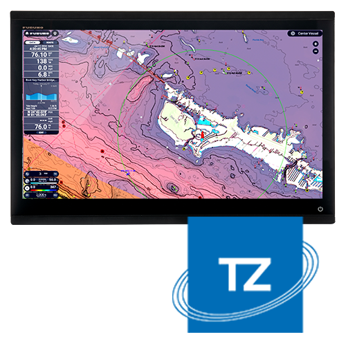
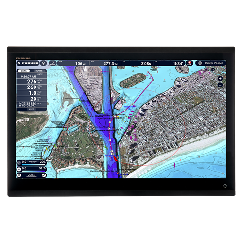
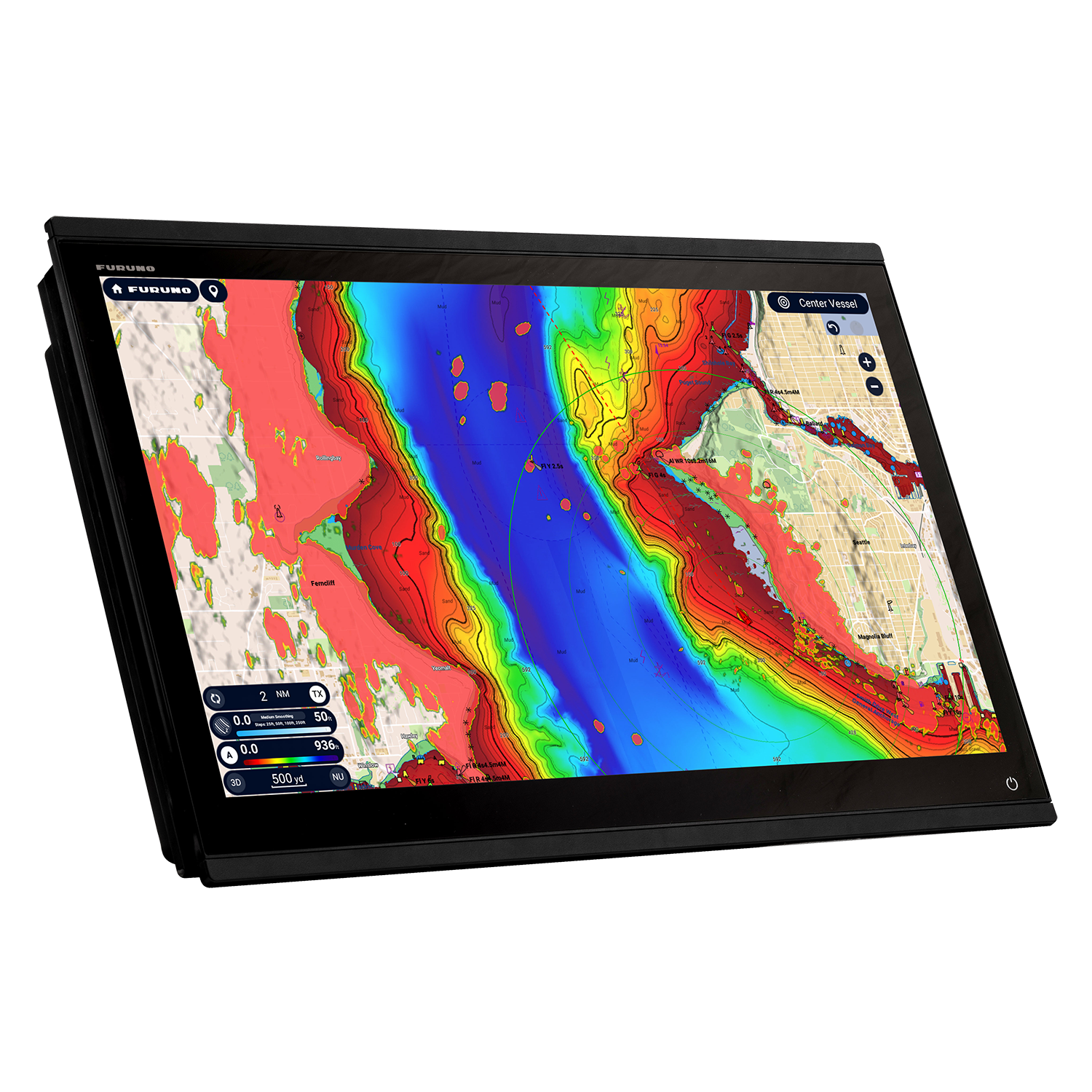
See more with TZ MAPS
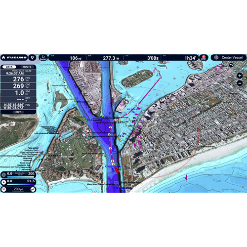
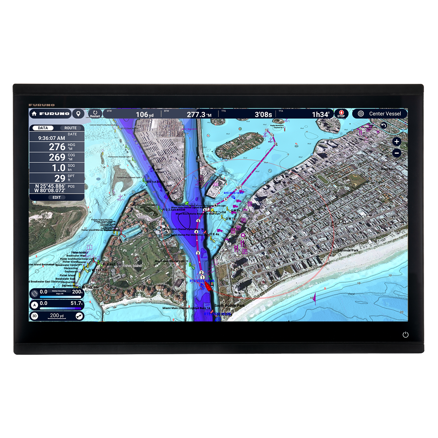
With TZ MAPS, navigators control what map data they want to download, such as incredibly wide chart areas, satellite photos, and bathymetric data. Purchase incredibly wide chart areas directly from the MFD! Custom depth color shading and bathymetric data overlays create navigational charts of unmatched detail and clarity, rendered with a variety of color themes to provide an electronic charting experience that goes far beyond any premium chart service before it. You can create your own custom objects or make updates to charted objects, such as buoys, so when they move from their previously charted positions, they can be updated on the system on the fly. Custom user objects can be shared with other registered TZ MAPS users through TimeZero's new moderated service, and can be turned on and off in the Layers menu, available with a single edge swipe up from the bottom of the display. Purchase of any TZ MAPS area also unlocks added functionality, such as powerful AI Routing that intelligently plans out routes, taking into consideration the boat's draft as well as charted depths and navigational obstacles. The purchase of any TZ MAPS chart unlocks those charts in the free TZ iBoat app for mobile devices such as a phone or tablet, providing you with a free home planning app that will transfer your points and routes directly to the TZtouchXL. With a free TimeZero account, waypoints and routes can be easily backed up or retrieved from the cloud with just a few taps, ensuring all the data you’ve worked so hard to create remains safe and secure.
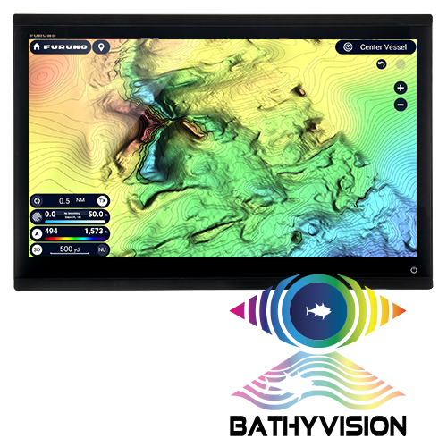
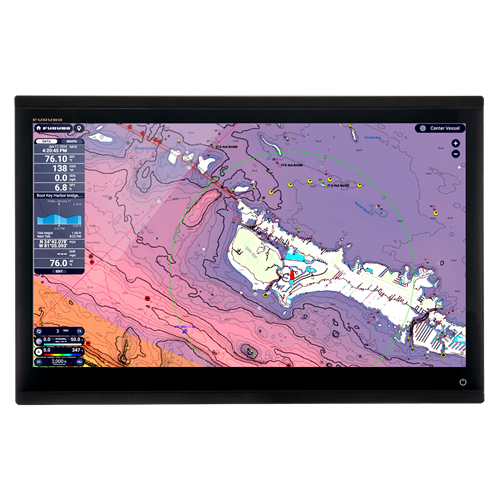
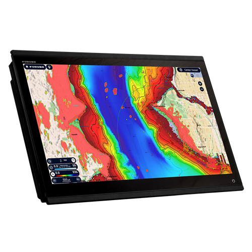
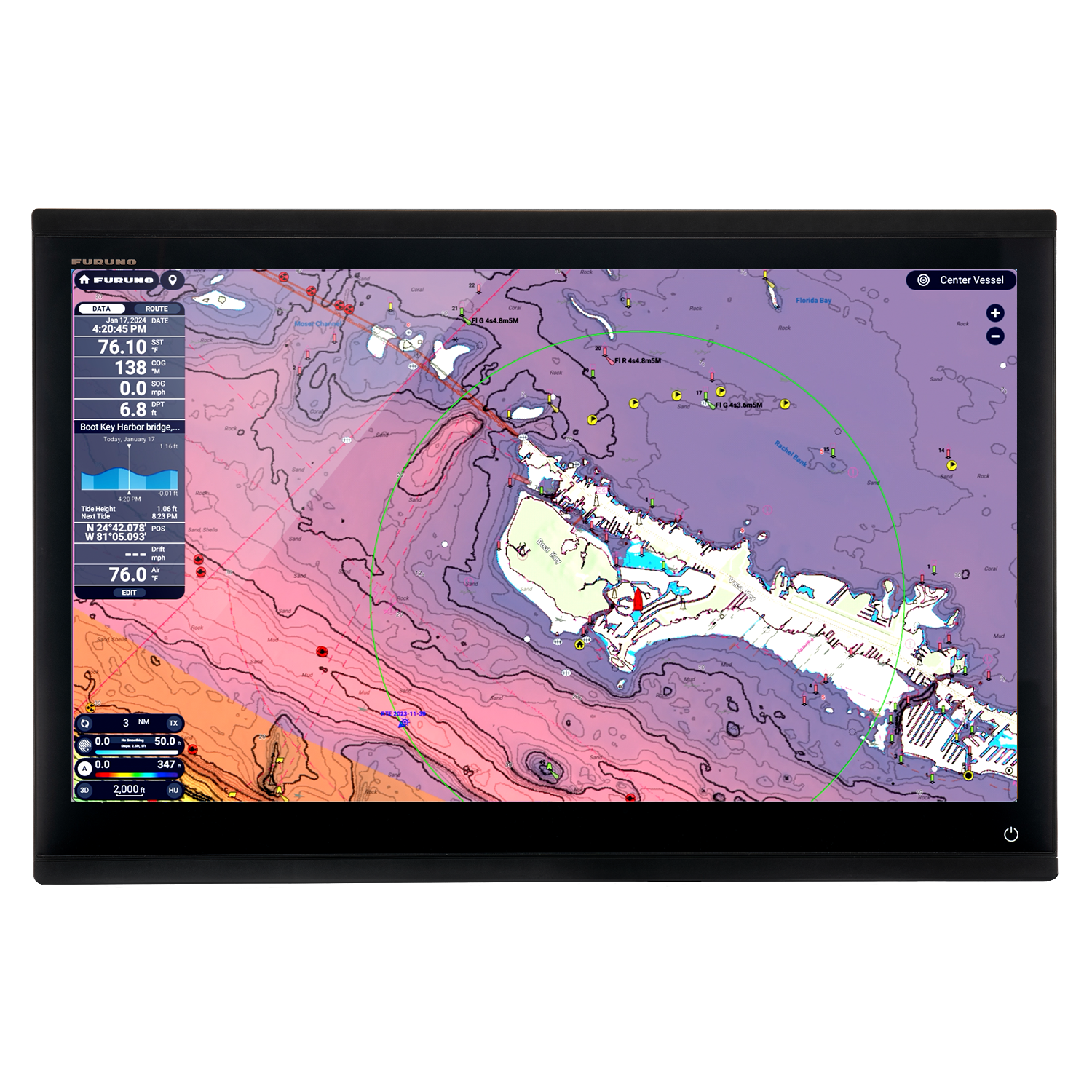
Experience 'off-the-charts' bathymetric data
with BathyVision
BathyVision for TZ MAPS provides truly ‘off the charts’ bathymetric data with contour lines that can be configured with a single tap. When we say configurable, we’re talking down to a resolution of a mere 3 inches between contours - that's 3x better than any other bathymetric chart currently on the market. Bathymetric data is rendered from the same high-resolution database used for TZ MAPS’ custom depth shading and can be overlaid onto the navigation charts to create fishing charts unlike any seen before.
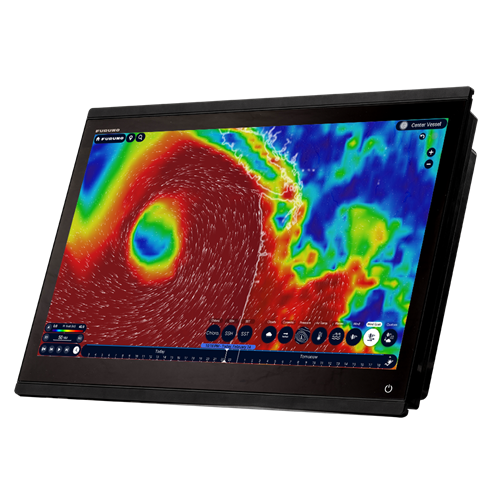
Keep ahead of the conditions with TZ Weather
TZ Weather delivers enhanced situational awareness and forecasting for mariners worldwide. The free TZ Weather service delivers global and regional weather predictions from NOAA's Global Forecast System (GFS) for any area you determine. A premium subscription service provides the ability to download higher-resolution data from a number of global models, including ICON, NAM CONUS, Arpège, and AROME. You can configure your MFD to download the latest weather immediately on startup.
TZ Weather offers detailed and localized forecasts, allowing you to select forecast duration, resolution, and data models tailored to your needs. The streamlined Weather Timeline & Layers interface makes it easy to view and interact with forecasts, while animated particles, wind barbs, and color shading provide an intuitive representation of changing conditions. Additional tools such as Meteograms and customizable presets help you pinpoint the best departure times and assess evolving weather patterns at specific locations.
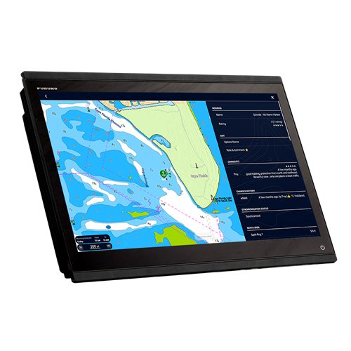
Find your safe harbor with Dynamic Mooring
Dynamic Mooring, revolutionizes the way boaters select safe anchorages by integrating real-time weather forecasts with TZ MAPS advanced mapping technology. With just a date selection and the current weather forecast downloaded, the system automatically analyzes the coming wind conditions and topography to provide a clear, color-coded mooring status: green for protected, orange for partially protected, and red for exposed. These mooring locations are extracted from high-resolution vector maps and enhanced by contributions from the TIMEZERO “Community Maps” network, ensuring an up-to-date and comprehensive anchorage database.
The Benchmark for Radar
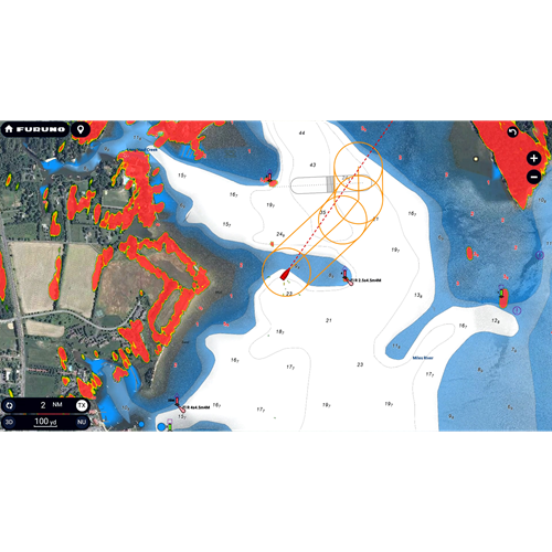
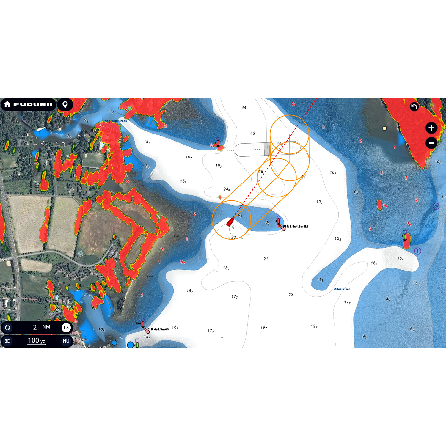
However you spend your time on the water, you need a Radar you can rely on to keep you safe. Whether you choose the time-tested X-Class magnetron option or NXT Solid-State Doppler models, Furuno Radar delivers power and clarity like you’ve never seen and provides the assurance that you’re navigating with the most reliable and feature-packed equipment on the planet. From the compact DRS2DNXT/DRS4DNXT domes to the high-power 200-watt DRS25ANXT open array, you’ll quickly become accustomed to the dynamic features that only Furuno provides, like Target Analyzer™ that alerts you to potentially hazardous targets, Fast Target Tracking that displays a speed and course vector in seconds, best-in-the-business Bird Mode to track elusive flocks and even individual birds feeding on baitfish, and Rain Mode that can pick out and display in different colors the targets you need to see through even the nastiest of squalls. Plus, TZtouchXL introduces new Radar features, like Risk Visualizer™ and AI Avoidance Route™, that help keep you safe on the water.
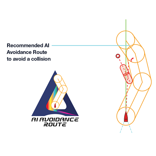
Risk Visualizer™ and AI Avoidance Route™
Risk Visualizer™ is a unique function of Furuno Radars that provides a visual representation of potential collision risks of approaching objects around the vessel. Unlike CPA/TCPA alarms which indicate only the risks visible on the ship’s current course, Risk Visualizer™ assesses all objects 360° around the vessel. Dynamic icons are automatically created for targets with the highest collision probability, ensuring the captain has the information needed to maintain safe distances when passing.
The new AI Avoidance Route™ feature available with TZ MAPS takes all the information provided by the Radar and instantly determines and provides a safe route around those hazards.
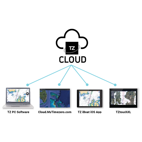
Never lose waypoints, routes, or settings again with TZ Cloud
Create your routes at home using TZ Navigator, a web browser*, or the TZ iBoat iOS App, then download them to your TZtouchXL MFD from the cloud. You can also backup all of the events on your MFD and retrieve them at home, because your data is synchronized automatically & securely. TZ Cloud saves all of your marks, routes, boundaries, photos, and catch data - with a free TimeZero account, all of your data can be backed up or retrieved with just a few taps. The purchase of any TZ MAPS chart directly from the MFD also unlocks those charts in the free TZ iBoat app for mobile devices such as a phone or tablet and TZ Pro navigation software, providing the only home planning solution you'll ever need.
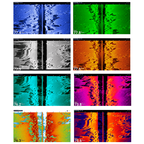
Built-In CHIRP Side-Scan
Furuno’s CHIRP Side-Scan for NavNet TZtouchXL scans both port and starboard, illuminating the shape of bottom structure in high definition. CHIRP Side-Scan reveals the shape of fish targets and fish-hoarding structure to each side of your vessel. CHIRP from 230kHz or 445kHz center frequencies with thru-hull, paired, or transom mount transducer options. CHIRP Side-Scan is built into the TZT10X/13X/16X, and can be accessed by any TZtouchXL MFD on the network.
CHIRP Side-Scan can be viewed in 8 different color presentations: White, Green, Blue, Orange, Aquamarine, or the new, high-contrast Tuna Hunter, Volcano, or Fury color palettes.
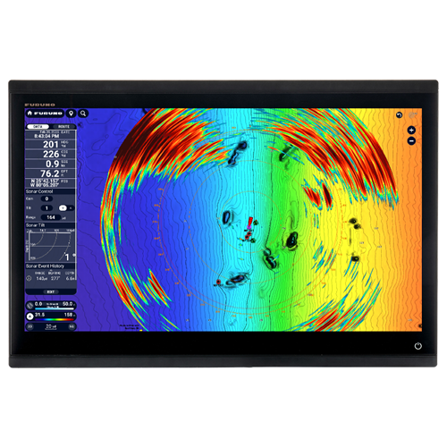
See around you like never before with the CSH10 Omni Sonar
Furuno’s CSH10 360° Scanning Sonar is now fully compatible with NavNet TZtouchXL, allowing seamless integration and total control. Once connected, the CSH10 is recognized as a native sensor, automatically unlocking a dedicated Sonar display on the MFD. Easily control CSH10 settings, adjust key parameters like tilt and gain, monitor system status, and create event marks to track important underwater targets.
With Furuno's unique Sonar Overlay, you can display real-time Sonar echoes directly on your chart, allowing you to see fish targets in relation to charted objects, structure, and underwater topography. Understanding where fish are located relative to wrecks, reefs, drop-offs, and other key underwater features enhances situational awareness and helps you make more informed decisions when fishing or navigating complex environments.
Total Control
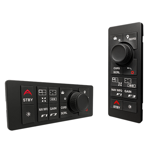
Looking for an added element of control? The vertically-oriented MCU006 and horizontal MCU006H are capable of controlling any TZtouchXL MFD in the network. Both feature a comfortable RotoKey™ and ten dedicated dual-purpose buttons that operate different functions, including the ability to access the Edge Swiping functionality that makes the NavNet TZtouch series so easy to use.
NavNet Command Center
Take control of third-party devices using an HTML browser on your NavNet TZtouchXL MFD. NavNet Command Center provides an interface for you to display and control an ever-expanding catalog of third-party equipment directly from the MFD. Onboard equipment such as Quick Bow Thrusters, Victron Energy Controllers, and Lumishore and Shadow-Caster LED Lighting can all be accessed and controlled from custom pages in full-screen or split-screen presentations.
Continuously Evolving
NavNet TZtouchXL is continuously refined to add new features to your system, and the Version 25 software update delivers a host of powerful new capabilities to your helm. Alongside a range of new features, user interface improvements, and enhanced search functions, Version 25 makes NavNet TZtouchXL smarter, more intuitive, and more powerful than ever before. Watch this short video to get a first look at some of the many new features that are now available in NavNet TZtouchXL.
- UHD Digital Radar Sensors
- Cables
- Related Products
- Smart Sensors
- Miscellaneous Accessories
UHD Digital Radar Sensors
UHD Digital Radar Sensors
NEW-12V-24V-16A is required for DRS25AX on 12VDC vessels and can also be used with DRS12ANXT/DRS25ANXT.
24" Solid-State Doppler Radar with Target Analyzer and Fast Target Tracking, less cable
Cables
Cables
Related Products
Related Products
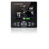
Self-Learning, Adaptive Autopilot - Single-Din Size Color Display for Outboards
External Black Box Weatherfax & Navtex Receiver w/5M PC Crossover Cable, Less Antenna
Fluxgate Magnetic Sensor With Enhanced Stability By A Solid-State Rate Gyroscope, w/ 6M Cable
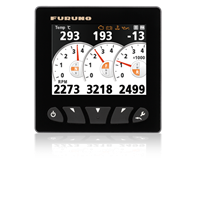
4.3" Color LCD Navigational Data Organizer - NMEA2000 & NMEA0183 compatible, w/6M NMEA2000 Cable
Smart Sensors
Smart Sensors
Miscellaneous Accessories
Miscellaneous Accessories
Recommended Additions
-
DRS25ANXT
$8,495.00200 Watt Solid-State Doppler Radar with Target Analyzer and Fast Target Tracking, less antenna and cableDetails -
GP330B
$425.00No Longer Available, Recommend the GP340Details -
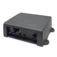
DFF3D
$2,195.00DetailsMultibeam Sonar for NavNet TZtouch/TZtouch2/TZtouch3, Less Transducer
-
DFF1-UHD
$1,695.00NLA / Recommend BBDS1Details -
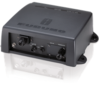
DFF3-UHD
$2,195.00High-Power TruEcho CHIRP Fish Finder for NavNet TZouch3 MFDs and the black box TZT2BB. Includes 5M LAN Cable. Less TransducerDetails