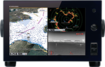
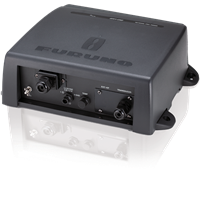
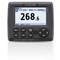
TZT14
No Longer Available
MSRP: $5,695.00
NO LONGER AVAILABLE
Chart TypeRaster or Vector or Satellite Photo or 3D Data
Display Size14 inches
Display TypeColor Multi Touch LCD
Power Usage12-24 VDC
Prices and Specifications Subject to Change Without Notice.
All prices shown are in USD. Prices are valid in US and Canada only.
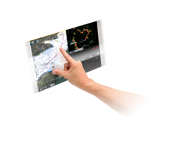
Nothing is faster than TimeZero
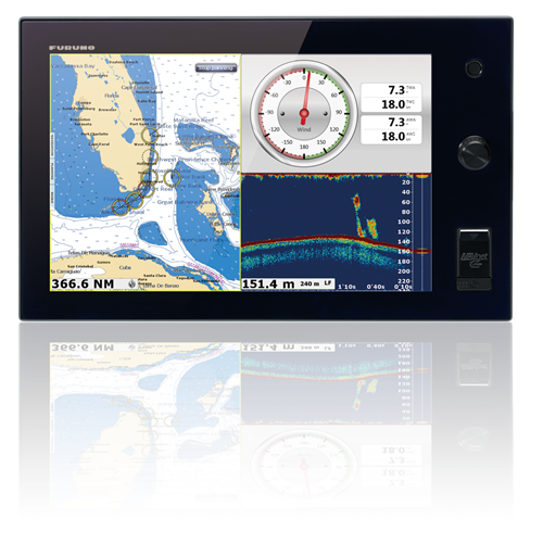
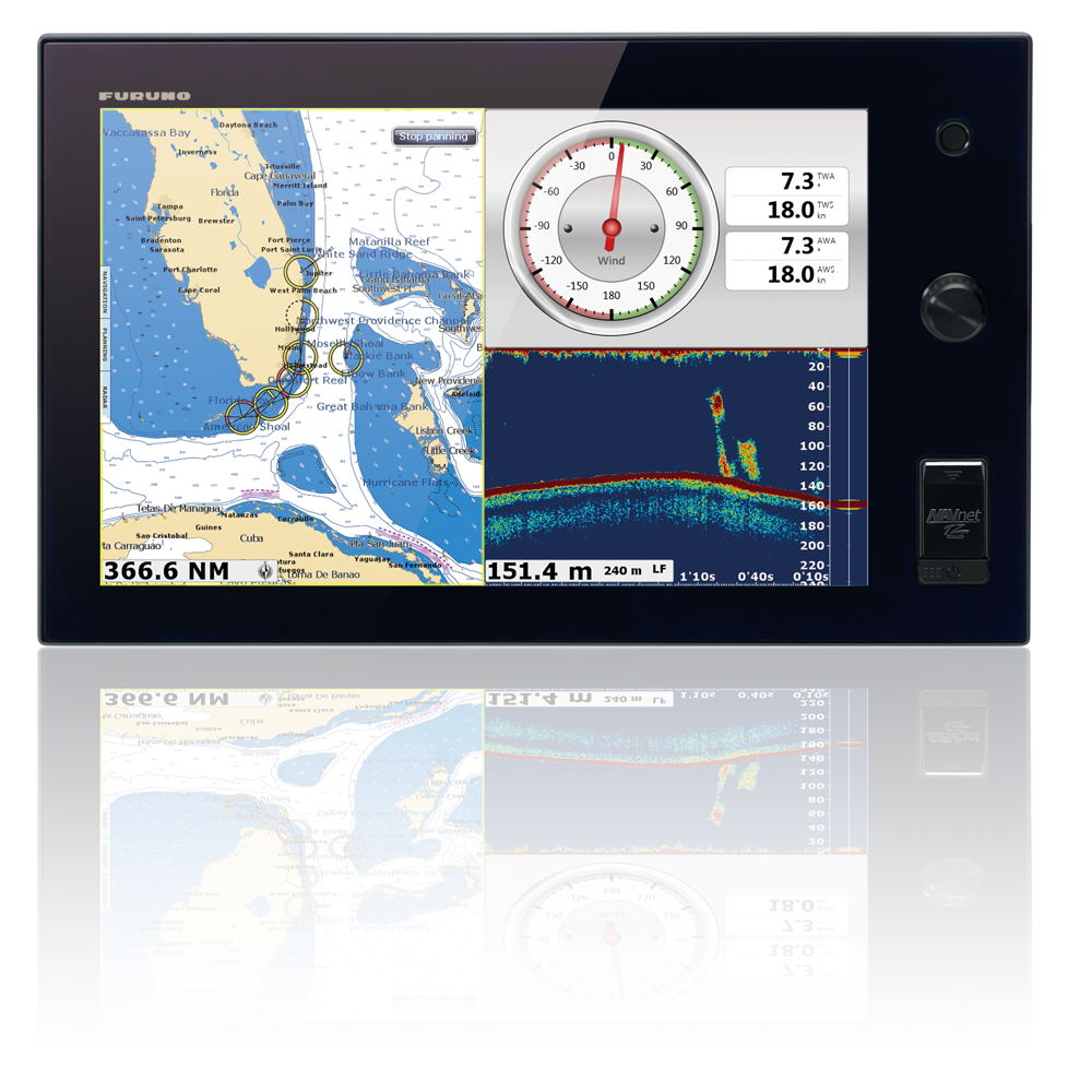
NavNet TZtouch’s TimeZero™ technology delivers chart processing like you’ve never seen before – seamless chart handling, zooming and panning without the screen disappearing. TimeZero™ technology redefines the meaning of stress-free operation by smoothing out your chart handling actions.
Equipped with powerful TimeZero™ technology, NavNet TZtouch will completely transform the way you navigate. You can scroll, pan, zoom in/out with a smooth, fast and seamless graphics engine. Navigating in a fully 3D environment offers you a true perspective and wider area of view around the ship, which allows you to better plan your routes, while TimeZero technology updates the information on your screen with virtually no redraw.
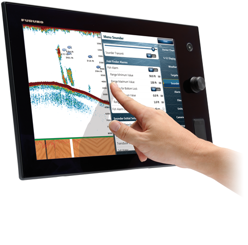
Multi touch control at your fingertips
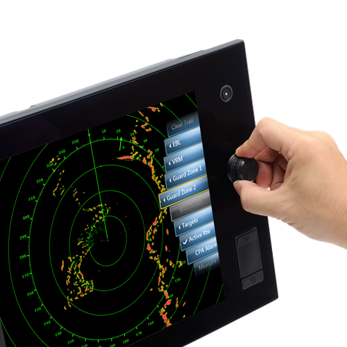
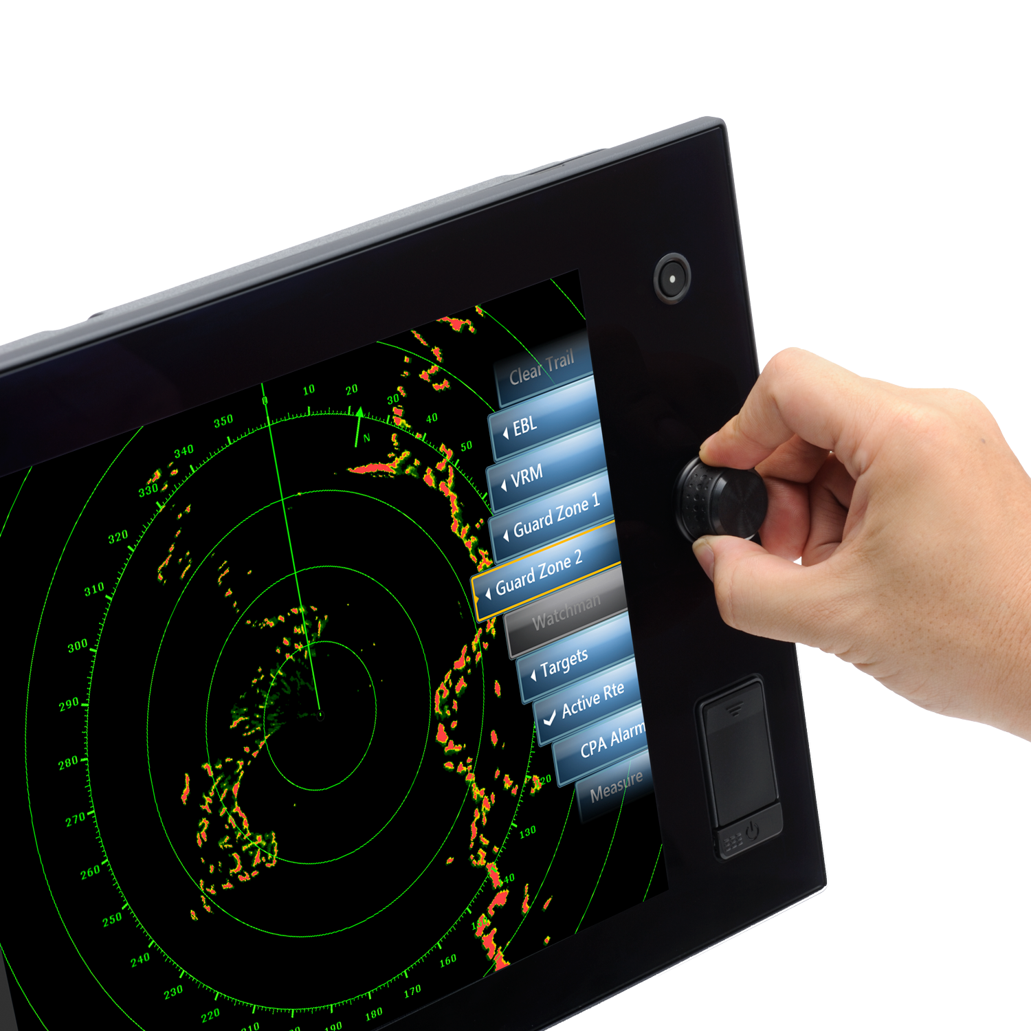
Furuno elevates marine touch screen technology to an entirely new level with the industry's first multi touch MFD. The use of multi touch technology opens the door to a wide variety of gesture-based commands. NavNet TZtouch's waterproof display is also ruggedized to perform perfectly in wet, harsh conditions.
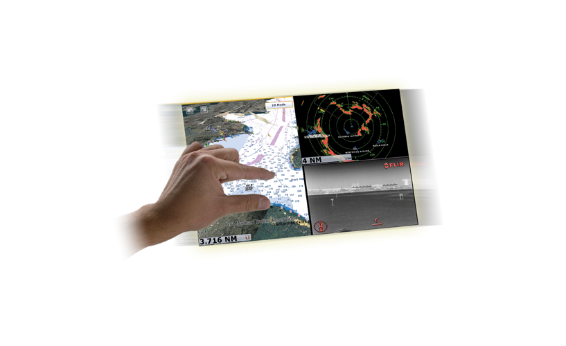
Pinch to zoom and other intuitive gestures
Be more hands-on with our easy-to-understand touch screen interface. TZtouch brings you pinch-to-zoom capability, as well as other multi touch gestures for the most intuitive navigation experience. You'll have full control of each component connected to the network right at your fingertips. Navigation is simplified by using your fingers to zoom and pan around the chart. As soon as your fingers touch the display, taps, pinches and swipes are instantly transformed into action. You will learn your controls so quickly that you'll be up and running in no time. To make operation even easier while underway, adjustments such as range and gain are easily made from either the on-screen touch menu or our patented RotoKey™.
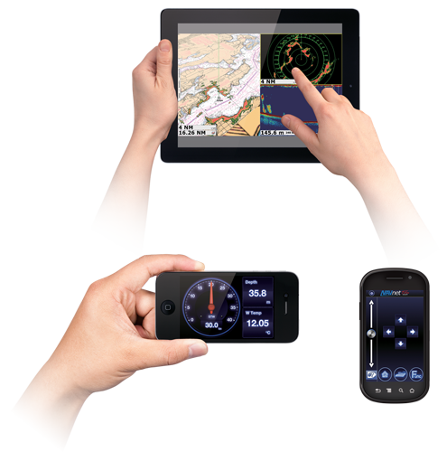
Remotely view and control your bridge with apps for your smartphone and tablet
Engineered to utilize the latest technology, NavNet TZtouch opens the door to cutting edge WiFi features, such as tablet and smartphone apps, points of interest (POI), real time weather data, software updates and more. Take full control of your NavNet in a whole new way. The TZtouch Remote app allows you to operate your system remotely with your smartphone or tablet over WiFi, when connected to the network.
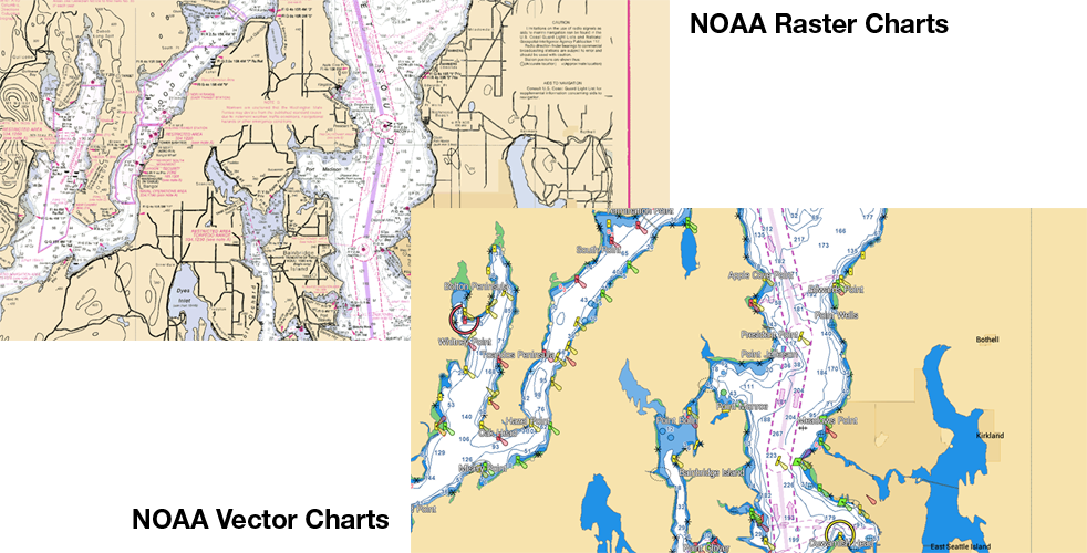
MapMedia Raster and Vector Chart Library
Freely choose the charts that fit your individual needs and preference. MapMedia's NOAA Raster and Vector charts for the U.S. Coasts, Gulf of Mexico, Alaska and Hawaii come pre-loaded. In addition, MapMedia brings you free satellite photos and detailed fishing bathymetric charts that can be download for the U.S. Outside of the U.S., "C-MAP" vector cartography can be purchased and downloaded to your NavNet with ease. MapMedia cartography integrates cutting edge algorithms with high resolution image processing techniques to deliver a fusion of digital navigation charts and satellite photography.

Satellite PhotoFusion™ offers a birds-eye view without obstruction of critical data
You can load any two ultra-wide high-resolution satellite photo areas at your convenience. Land areas (zero depth) are completely opaque, so these areas are displayed as high-resolution satellite photos on the chart. As the depth increases, the satellite photography becomes more transparent. This allows you to see where the shallows end and the deeper water begins, while still allowing the raster or vector chart to be visible.
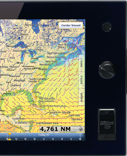
Free & easy-to-use marine weather forecasts
The weather tool is completely free and easy to use, giving you unlimited access to weather forecasts worldwide 24 hours a day provided by NavCenter. Select geographic coverage, data type, period of time, and then choose how to receive the file. NavNet TZtouch provides up to 16 days of weather forecasting.
- UHD Digital Radar Sensors
- Cables
- Related Products
- Smart Sensors
- Marine Monitors
- Miscellaneous Accessories
- Manuals
UHD Digital Radar Sensors
UHD Digital Radar Sensors
NEW-12V-24V-7A is required for DRS6AX/DRS12AX/12ANXT/25ANXT on 12VDC vessels or DRS6ANXT for cable runs longer than 10M
NEW-12V-24V-16A is required for DRS25AX on 12VDC vessels and can also be used with DRS12ANXT/DRS25ANXT.
24" Solid-State Doppler Radar with Target Analyzer and Fast Target Tracking, less cable
Cables
Cables
Related Products
Related Products
Self-Learning, Adaptive Autopilot - Single-Din Size Color Display for Outboards
External Black Box Weatherfax & Navtex Receiver w/5M PC Crossover Cable, Less Antenna
Fluxgate Magnetic Sensor With Enhanced Stability By A Solid-State Rate Gyroscope, w/ 6M Cable
4.3" Color LCD Navigational Data Organizer - NMEA2000 & NMEA0183 compatible, w/6M NMEA2000 Cable
High accuracy Satellite Compass with a compact 2-sensor antenna. Uses GPS, Galileo and/or GLONASS satellite systems to ensure the highest precision and coverage. 0.4 degree course accuracy
4.3 Inch Color LCD Display, Satellite Compass with Three GPS Antenna Receivers (0.25 degree Heading Accuracy)
Smart Sensors
Smart Sensors
Marine Monitors
Marine Monitors
Miscellaneous Accessories
Miscellaneous Accessories
64GB SD Card - NavNet TZtouch Satellite Photo Data for the East Coast U.S. and Gulf of Mexico
64GB SD Card - NavNet TZtouch Satellite Photo Data for Central U.S. Rivers, Great Lakes and Gulf of Mexico
64GB SD Card - NavNet TZtouch Satellite Photo Data for U.S. West Coast, Hawaii and Southern Alaska
Manuals
Manuals
Recommended Additions
-
NAVPILOT 711C
$3,295.00DetailsSelf-Learning, Adaptive Autopilot - Single-Din Size Color Display
-
DFF3D
$2,195.00DetailsMultibeam Sonar for NavNet TZtouch/TZtouch2/TZtouch3, Less Transducer
-
DFF1-UHD
$1,695.00NLA / Recommend BBDS1Details -
SC70
$5,695.00DetailsHigh accuracy Satellite Compass with a compact 2-sensor antenna. Uses GPS, Galileo and/or GLONASS satellite systems to ensure the highest precision and coverage. 0.4 degree course accuracy
-
SC130
$11,895.00Details4.3 Inch Color LCD Display, Satellite Compass with Three GPS Antenna Receivers (0.25 degree Heading Accuracy)


 Multi Function Displays
 Radars
 Fish Finders & Transducers
 GPS & Chart Plotters
 Autopilots
 Navigation
 Sonars
 Commercial