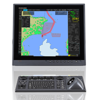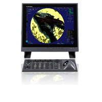
PS100/HATPSCOMP
MSRP: $11,995.00
Voyage Planning Station PC loaded with PS100 program
Prices and Specifications Subject to Change Without Notice.
All prices shown are in USD. Prices are valid in US and Canada only.
Safer and more efficient navigation at your fingertips
From voyage planning to monitoring, the PS100 Voyage Planning Station supports safer and more efficient navigation every step of the way. The PS100/HATPSCOMP is a full software/hardware solution, with the program pre-installed on a purpose-built PC. This combination's unique rendering technology enables high-speed drawing and seamless operation on 4K-compatible high-definition charts. Its intuitive graphic interface is specialized for voyage planning with a suite of user-friendly tools at your fingertips, including NAPA Voyage Optimization that improves voyage efficiency by optimizing routes and speed profiles.

Remarkably Seamless Operation
The PS100 features 4K high-definition images suitable for large-screen displays while achieving smooth operation for stress-free voyage planning and monitoring.

Simple and intuitive GUI
With a Graphical User Interface (GUI) specifically designed for voyage planning and touchscreen interface for easy and intuitive use, the PS100 is makes planning and monitoring your voyage a breeze. Floating windows allow you to move settings screens, information frames, and documents to any location within the frame with a single touch.

Calculate recommended ship speed
You can easily create new routes, edit existing routes, and create new points, lines, areas, and circles by simply tapping the screen. By setting ETD/ETA for each waypoint in the route, the recommended ship’s speed can be calculated and displayed automatically. The results of the route analysis in your planning routes are automatically displayed with green, yellow, and red color-coded status.

Route comparison and playback
Display and review multiple routes for comparison, including new routes you wish to assess and routes previously utilized. This feature is valuable for sharing information among crew members.

Sensor Information
Heading, speed, course over ground, speed over ground, and own ship position are displayed on the ENC chart, and position information of the vessel is automatically recorded as a voyage log along with the sensor information. With a single click on the menu, you can overlay Radar images and check landforms and sea obstacles if the ECDIS, Radar, and AIS are connected to the same network. It is also possible to superimpose the trail display.

AIS Target Tracking
AIS target information and TT information can be displayed if the ECDIS, Radar, and AIS are connected to the same network. In addition, you can select the display status (target information, position display, filter addition, selected target pause/activation, etc.) from the list of targets.

Weather Data
Weather information for around the globe can be superimposed by importing data quickly and easily.

Automatic Data Synchronization
Automatic synchronization with ECDIS on the same network eliminates the hassle of data transfer. Routes and user charts created with the PS100 and ECDIS can be shared between units. Data that is created or modified is automatically distributed to other units, eliminating the need for manual data migration.
Shareable Data:
- Charts
- Route files
- User chart
- Own ship parameters
- Sensor information used by ECDIS
- Radar overlay
- Own ship setting
- Voyage log

Document Viewing and Schedule Management
You can centrally manage information by importing documents into the planning station. In addition, by attaching documents to any user chart object, you can efficiently view and share information in the sea areas and timings where confirmation of documents is required.

NAPA Voyage Optimization improves voyage efficiency
Voyage Optimization, an operation performance optimization service provided by NAPA, can be accessed through Service Gateway Gate-1 (optional). NAPA Voyage Optimization is a solution that leverages a vessel's unique performance model to optimize the voyage plan (route/vessel speed allocation), enhance operational safety, and decrease fuel consumption and GHG emissions.
- Product Consists Of
- Marine Monitors
Product Consists Of
Marine Monitors
Marine Monitors
Recommended Additions
-
FMD3200BB
$14,539.00DetailsBlack Box Electronics Chart Display and Information System (ECDIS) w/o Display
-
FAR3025
Call For PriceFAR3005 Series Black Box Chart Radar with Performance Monitor, 25kw X-Band, 96 NM, less Display, Antenna, and Signal CableDetails -
FAR3220BB
Call For PriceBB CHART RADAR X-25KW W/PM*Details


 NavNet MFDs
 Radars
 Fish Finders & Transducers
 GPS & Chart Plotters
 Autopilots
 Navigation
 Sonars
 Commercial