
 Multi Function Displays
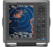 Radars
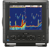 Fish Finders & Transducers
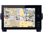 GPS & Chart Plotters
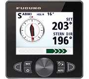 Autopilots
 Navigation
 Sonars
 Commercial
TZ MAPS On NavNet TZtouchXL Provides Dramatic Advancement In Chart And Marine Data Display
TZ MAPS is built from official hydrographic data, high-resolution bathymetry, satellite imagery, and crowd-sourced surveys, providing an unparalleled level of detail, control, and real-time awareness on the water.

AI Routing on NavNet TZtouchXL automatically generates optimal routes
based on charted hazards, depth contours, and navigation rules
Camas, WA - Furuno has redefined marine navigation with the introduction of TZ MAPS on NavNet TZtouchXL, delivering the most advanced and customizable charting platform ever developed for recreational and professional mariners. Built from official hydrographic data, high-resolution bathymetry, satellite imagery, and crowd-sourced surveys, TZ MAPS provides an unparalleled level of detail, control, and real-time awareness on the water.
TZ MAPS unlocks powerful new features on TZtouchXL MFDs (Multi Function Displays), including AI Routing, AI Avoidance Route™, BathyVision™, and more.
AI Routing is a game-changing addition to the TZtouchXL ecosystem. This intelligent routing engine automatically generates optimal routes based on charted hazards, depth contours, and navigation rules, dramatically reducing route planning time and minimizing risk. Whether you're plotting a course for a long cruise or simply moving between waypoints, AI Routing helps ensure a safe, efficient, and stress-free voyage.
When connected to a Furuno Solid State NXT Radar, AI Avoidance Route™ utilizes all the information provided by TZ MAPS and real-time Radar returns to instantly provide a safe route around hazardous targets. It all starts with Risk Visualizer™, a unique feature that shows potential collision areas based on the current position and movement of all surrounding vessels, providing a quick and intuitive overview of the situation around your boat. When Risk Visualizer™ warns you of a potential collision, the new AI Avoidance Route™ calculates and plans your next move. It intelligently draws a suggested collision avoidance route that you can steer to avoid the collision, keeping you and your vessel safe.
With TZ MAPS, navigators can customize their charts to match the way they fish or cruise. Layers, including satellite photos, contour lines, and 3D bathymetric views, can be combined and fine-tuned to suit any condition or activity. Powerful features like BathyVision™ bring the seafloor to life with contours down to 3-inch resolution and vivid shading that reveals ridges, drop-offs, canyons, and structure in stunning clarity, giving captains a true-to-life sense of underwater terrain.
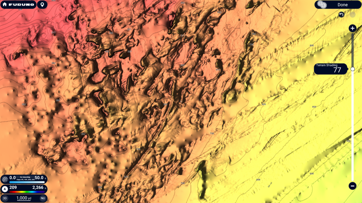
The custom color palettes and terrain shading on TZ MAPS give navigators
an electronic charting experience that goes far beyond any premium chart service before it
TZ MAPS includes user-selectable terrain shading and color themes, allowing boaters to tailor the visual experience to suit any lighting or preference. Whether navigating in bright daylight or low-light conditions, TZ MAPS ensures optimal readability and situational awareness.
A major innovation within TZ MAPS is its Community Maps feature, which empowers users to contribute local knowledge by creating and editing chart objects, uploading photos, and adding comments directly from the TZtouchXL display. Crowd-sourced data is curated and continually updated, providing real-world insights from fellow mariners and ensuring that charts evolve with the community. Users also vote on the data with a thumbs-up or thumbs-down to let Furuno know if the update is accurate.
Unlike static charts, TZ MAPS is a dynamic, intelligent system that receives regular updates with the latest bathymetric and cartographic data, including community contributions. Updates are delivered seamlessly to the TZtouchXL MFD, keeping boaters equipped with the most accurate and current information available. Updates are free for one year with the purchase of a chart area; after this period, navigators can continue to receive updates with a small annual subscription. TZ MAPS charts can be purchased and unlocked directly from the TZtouchXL MFD, plus they are automatically unlocked in the free TZ iBoat app, making route planning from home a breeze.
When combined with other Furuno innovations, such as PBG (Personal Bathymetric Generator), Fish-It/Drift-It, and Bottom Discrimination, TZ MAPS becomes an indispensable tool for locating productive fishing grounds, uncovering hidden structure, and making smarter decisions on the water. Cruisers and explorers benefit from enhanced coastal detail, land features, ports, and aerial overlays that deliver confidence and clarity at every destination.
TZ MAPS is more than a chart. It's a fully interactive, user-driven cartography platform designed specifically for the TZtouchXL ecosystem. With this powerful new capability, Furuno once again raises the bar for what marine navigation can be.
These are just some of the incredible new features available with TZ MAPS. To learn more about TZ MAPS and NavNet TZtouchXL, visit the website at www.NavNet.com/TZtouchXL or find your local Furuno dealer on their website at www.FurunoUSA.com.
###